australia"

Residents in parts of Queensland and NSW are being urged to keep an eye out for thunderstorms on Sunday which could bring heavy rainfall, damaging winds and large hail.
The Bureau of Meteorology issued thunderstorm forecasts on Sunday, warning storms are possible for vast swathes of central and south-east Queensland. Isolated severe storms, mostly inland, are also a possibility.
“Heavy rainfall is the primary hazard, but damaging winds and large hail are also possible,” the Bureau’s notice said.

Further south, there is also a chance of storms developing in northern NSW which could affect areas around Moree, Inverell and Kempsey.
“Isolated severe storms over the Northern Tablelands and adjacent inland parts of the coast may bring heavy rainfall, damaging winds, and large hail,” the NSW forecast said.
The Bureau stated it was poised to issue weather alerts should the weather ramp up as the day progresses.
Sky News Weather Presenter Lucy Polkinghorne said the storms could possibly become severe in some areas.
“Today for Queensland, onshore flow will start to redevelop in the east so that is going to aid showers and also some thunderstorms, possibly severe, particularly for northeast NSW and south-east Queensland,” Ms Polkinghorne said on Sunday.
â›ˆï¸ Thunderstorm FORECAST for TODAY (10/11): Chance of storms through north-east #NSW this afternoon and evening. Isolated severe storms over the Northern Tablelands and adjacent inland parts of the coast may bring heavy rainfall, damaging winds, and large hail. pic.twitter.com/DxQ8Dcnm9G
— Bureau of Meteorology, New South Wales (@BOM_NSW) November 10, 2024
â›ˆï¸ Thunderstorm FORECAST for TODAY (10/11): Isolated severe storms possible in parts of central and south-east #Queensland today, mostly inland. Heavy rainfall is the primary hazard, but damaging winds and large hail are also possible.
— Bureau of Meteorology, Queensland (@BOM_Qld) November 10, 2024
More: https://t.co/oQJP0oAXFT pic.twitter.com/AljqGvKZbf
“So, we are certainly keeping our eyes on that. And do be careful if you are in these regions, as I mentioned, these thunderstorms can potentially be severe.
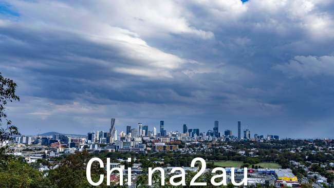
“You can see that thick dark cloud really building across the east of the country but we are also watching this large cloud band stretching from the east of WA into southern parts of NSW and this is associated with this broad trough here that is producing some rain, showers and storms across the middle of the country.
“It’s quite unseasonable rain for this time of year.”
Meanwhile, heatwave warnings remain current for vast swathes of Queensland, the Northern Territory and Western Australia, with hot air slowly pushing further north as the weekend winds down.
In the sunshine state, temperatures could reach into the high thirties to low forties.
“Severe heatwaves can be dangerous for many people, especially older people, babies, children, pregnant and breastfeeding women, people with medical conditions and people who are unwell,” the Bureau advised.
“Seek a place to keep cool, such as your home, a library, community centre or shopping centre. Close your windows and draw blinds, curtains or awnings early in the day to keep the heat out of your home.
“If available, use fans or air-conditioners to keep cool.”
澳洲中文论坛热点
- 悉尼部份城铁将封闭一年,华人区受影响!只能乘巴士(组图)
- 据《逐日电讯报》报导,从明年年中开始,因为从Bankstown和Sydenham的城铁将因Metro South West革新名目而
- 联邦政客们具有多少房产?
- 据本月早些时分报导,绿党副首领、参议员Mehreen Faruqi已获准在Port Macquarie联系其房产并建造三栋投资联