《每日电讯报》3月9日报道称,受新州洪水危机影响,悉尼、Illawarra和South Coast数百条道路关闭。
新州恶劣天气状况或已有所缓解,但当局警告驾车者,多处道路仍处于受损或关闭中。
以下关闭列表中包括悉尼西部和西北部受河水上涨、洪水袭击和山体滑坡影响的多条主要道路(周三上午更新数据)。
(图片来源:《每日电讯报》)
Blacktown Council:
• WINDSOR – Hawkesbury Valley Way between Day Street and George Street
• MCGRATHS HILL – Windsor Road between Pitt Town Road and Macquarie Street
• COLO – Putty Road between East Kurrajong Road and Wheelbarrow Ridge Road
• GALSTON TO HORNSBY HEIGHTS – Galston Road between Calderwood Road and Montview Parade
• CATTAI – Wisemans Ferry Road at Little Cattai Creek
• NARRABEEN TO OXFORD FALLS – Wakehurst Parkway
• OXFORD FALLS – Oxford Falls Road West between Wakehurst Parkway and Aroona Road
• AUDLEY – Audley Weir between Audley Road and Sir Bertram Stevens Drive
• YARRAMUNDI – Springwood Road at Yarramundi Bridge Above Nepean River (bridge closed)
• WINDSOR – Bridge Street (Windsor Bridge) between Macquarie Street and Wilberforce Road
• NORTH RICHMOND – Terrace Road between Bells Line Of Road and Brahma Road
• PITT TOWN – Pitt Town Road, Cattai Road And Wisemans Ferry Road between O’Briens Road and Wolseley Road
• MARAYLYA – Cattai Ridge Road between St Johns Road and Halcrows Road
• NORTH TURRAMURRA – Bobbin Head Road between Memorial Road and Ku-ring-gai Chase Road
• ELDERSLIE – Argyle Street between Camden Valley Way and Edward Street
• SHANES PARK – Stony Creek Road/St Marys Road at South Creek
• SCHOFIELDS – Grange Ave at Eastern Creek
• LANE COVE – Riverside Drive between Delhi Road and Lane Cove Road
• DOUGLAS PARK – Douglas Park Causeway above Nepean River
• MARAYLYA – Mcclymonts Road at Cattai Creek
• ANNANGROVE – Blue Gum Road at Blue Gum Creek
• RIVERSTONE – Garfield Road West between Richmond Road and Railway Terrace
Camden:
• MENANGLE – Menangle Road at Menangle Bridge Over The Nepean River
• LEPPINGTON - Anthony Road,
• CAMDEN - Sheathers Lane (between Cawdor Road and The Old Oaks Road)
• GRASMERE - Smalls Road at Sickles Creek
• KIRKHAM - Kirkham Lane
• CAMDEN - Onslow Oval,
• GRASMERE - Cawdor Road (Between Murray Street and Burragorang Road)
• COBBITTY - Cut Hill Road (Cobbitty Road Intersection)
• CAMDEN - Little Sandy Bridge
• KIRKHAM - Macquarie Grove Bridge
• COBBITTY - Cobbitty Bridge
Wollondilly:
• WALLACIA - Blaxland Crossing (Wallacia Bridge)
• YERRANDERIE - Oberon-Colong Stock Route
• DOUGLAS PARK - Douglas Park Gorge
• APPIN - Broughton Pass
• WALLACIA - Bents Basin Road (Causeway)
• MENANGLE - Woodbridge Road (at the intersection of Finns Road)
• BROWNLOW HILL - Werombi Road (from Cobbitty Bridge to Stanhope Road)
• MENANGLE - Menangle Bridge
• CAWDOR - Cawdor Road (from Doncaster Ave to Ultimate Paintball)
• THE OAKS - Glendiver Road,
• TAHMOOR - Station Street (between Nattai Street and Bargo River Road)- residents only
• PICTON - Barkers Lodge Road at Argyle Street and Mulhollands Road
• RAZORBACK - Old Razorback Road
• BROWNLOW HILL - Brownlow Hill Loop Road (at the intersection of Paschendaele Place)
Blacktown:
• SCHOFIELDS - Carnarvon Rd
• MT DRUITT - Durham Road,
• SHANES PARK - Stoney Creek Rd (from Palmyra which includes the causeway)
• SCHOFIELDS - Kerrie Rd at Angus Rd
• SCHOFIELDS - Grange Ave
• SHANES PARK - Eighth Ave
• MARSDEN PARK - Excelsior Ave
• RIVERSTONE - Riverstone Rd at Clarke St
• RIVERSTONE - Walker Parade
• SHANES PARK - Palmyra Ave to South Creek Rd
• RIVERSTONE - Riverstone Parade (Church St to King St)
Hills Shire:
• Blue Gum Rd, Annangrove (at bridge crossing)
• McClymonts Rd, Maraylya (at bridge crossing)
• Cattai Ridge Rd, Maraylya/Glenorie (at bridge crossing)
• 313-337 Pitt Town Rd, Maraylya (at bridge crossings)
• Newman Rd, Glenorie
• River Rd, Lower Portland/Leets Vale: at 290 (Dargle Turf Farms), 990-1027 (Blundells Swamp), 1558 ( Cliftonville Ski Lodge), 2255-2275, and at Webbs Creek Ferry.
Liverpool:
• Gurner Ave in Austral
• 4th Ave at the intersection of Fourth and Sixth in Austral
• 5th Ave at the intersection of Fourth and Fifth Ave in Austral
• 12th Ave at the intersection of Fourth Avenue in Austral
• May Ave at Rossmore Avenue to Wynard Avenue in Rossmore
• Ramsay Ave at the intersection Wynyard and Ramsay in Rossmore
• North Ave in Rossmore
Southern Highlands:
• Boardman Rd near Old South Rd, Bowral
• Old South Rd near Bowral St, Bowral
• Range Rd, Mittagong between Old South Rd and Tourist Rd
• Railway Pass overbridge at Range Rd, Mittagong
• Railway St at Argyle St intersection, Moss Vale (water over road - use caution)
• Railway underpass at Spring St, Moss Vale (water over road - use caution)
• Lackey Rd, Moss Vale
• Dangerous sinkhole at Illawarra Highway near Burrawang
• Old Mandemar Rd, Berrima
• Oldbury Road, Sutton Forest
• Berrima Rd near railway crossing (water over road - use caution)
• Railway underpass at Badgerys Way, Exeter
• Collapsed bridge near the intersection of Belmore Rd and McEvilly Rd, Robertson
• Drapers Rd, Braemar
• Drapers Rd, Colo Vale
• Old Hume Highway at Alpine (water over road - use caution)
• Old Hume Highway at Yerrinbool (water over road - use caution)
• Canyonleigh Rd at Paddys River
• Inverary Rd, Paddys River
• Spring Hill Rd off Wombeyan Caves Rd
• Wombeyan Caves Rd near Goodmans Ford
• Landslide at Moss Vale Rd between Cambewarra and Fitzroy Falls
• Fallen tree on the Illawarra Highway at Macquarie Pass
Bega:
• Tathra Rd at Jellat Flats
• Tathra Rd, Bega between Howard Ave and East St
• Bega St at Bega Recreation Ground
• Carp Street, Bega at Kisses Lagoon
• Poplar Ave, Bega at Carp St and Valley St
• Big Jack Mountain Rd at Towamba River, Burragate
• Tathra Bermagui Rd at the Wapengo causeway, Wapengo
• Devils Hole Rd, Devils Hole
• Wallagoot Lane between Rixon’s Bridge and the causeway, Wallagoot
• Benny Gowings Rd at Murrah River Bridge, Murrah
• Wandella Rd at Wandella Creek Causeway
• Big Jack Mountain between Mt Darragh Road and national park rest area, Rocky Hall
• East St at the racecourse causeway, Bega
• Angledale Rd at Jaunceys Bridge
• Murrays Flat Rd, Tarraganda
• Forest Ln at the causeway, Millingandi
• Millingandi Rd at the causeway, Millingandi
• Millingandi Shortcut Rd at the creek crossing, Millingandi
• Orchard Rd at the causeway, Rocky Hall
• Tarlingtons Ln at Tantawangalo Creek causeway, Tantawangalo
• Big Jack Mountain Rd at Reedy Creek causeway, Burragate
• Church Ln at Tantawangalo River causeway, Tantawangalo
• Angledale Rd at Doctors Creek, Angledale
• Parrabel St at the intersection with Angledale Rd, Angledale
• Buckajo Rd between Ridge St and Grosses Creek Rd, Buckajo
• Jacksonia Grove at the causeway, Bega
• Pericoe Rd at Towamba River Bridge
• Frogs Hollow Ln at the causeway, Frogs Hollow
• Towamba Rd at Stoney Creek causeway, Towamba to Burragate
• Wonboyn Rd at Watergums Creek Bridge, Wonboyn
• Wonboyn Rd at Wonboyn River Bridge, Wonboyn
• Blanchards Rd at House Creek, Brogo
• Westrops Rd at Coolagolite Creek causeway
Shoalhaven LGA:
• Kangaroo Valley Rd
• Bugong Rd
• Moss Vale Rd between Main Rd and Myra Vale Rd
• Tannery Rd
• Browns Mountain Rd
• Hockey’s Ln
• Meroo Rd
• Edwards Avenue
• Coolangatta Rd
• Hanigans Rd
• Back Forest Rd
• Shoalhaven Heads Rd
• Bolong Rd
• Scenic Drive Paringa Park
• Wharf Rd Nowra
• Terara Rd
• Comerong Island Rd
• South St
• Comerong Island Rd
• Greens Rd
• Cnr Milbank and Greenwell Pt. Rd
• Fraser Rd
• Worrigee Rd
• Cnr St Annes and Berry St
• Yalwal Rd
• Burrier Rd
• Forest Road
• Old Princes Highway and Dowling Street Falls Creek
• Woollamia Falls Rd
• Callala Bay Rd
• Woollamia Road
• Currarong road
• Hawke St Duncan St
• Larma Ave The Wool Rd
• Lumeah Avenue to Boronia Avenue
• The Park Drive
• Tallyan Point Road and The Grange Road
• Jacobs Dr
• River Rd
• Gordon St Ellmoos Av
• Murrays Rd
• Dolphin Point Rd
• Tabourie Tourist Park Rd
• Monkey Mountain Rd
• Currowan Western Distributor
Eurobodalla Shire:
• Old Highway, Narooma - at Olsons Creek
•Tyrone Bridge, Bodalla
• Hawdons Road, North Moruya - at the causeway
• Old Highway, Tilba - at Tilba winery
• Potato Point Rd, Bodalla - at Borang Creek
•Dwyers Creek Rd, Moruya - at the causeway
•Old Bolaro Rd, Nelligen - at the causeway
•Silo Farm Bridge, Bodalla
•Sunnyside Rd, Mystery Bay - at the causeway
•Kiora Bridge, Araluen Road
•River Rd, Nelligen - at the causeway
Goulburn:
• Airport Rd
• Blackshaw Rd – At the Goulburn Golf Club
• Brisbane Grove Rd
• Bullspit Rd
• Bullamilita Rd
• Brayton Rd - At the Upper Lachlan Shire boundary
• Currawang Rd- At the first causeway
• Chinamans Lane – At the causeway
• Fenwick Creek Rd – Off Crookwell Rd
• Highlands Way – At the Viaduct
• Lumley Rd– South of Bullamilita Road at the concrete causeway
• Oallen Ford Rd - At Windellama Creek
• Mills Rd
• May Street Bridge
• Murrays Flat Rd
• Mayfield Rd - At the Queanbeyan Palerang boundary
• Painters Lane
• Park Rd – From roundabout at Forbes Street to Sloane Street (Blackshaw Rd Underpass)
• Rhyanna Rd – At the Tarlo River
• Stewarts Crossing
• Sandy Point Rd- Mayfield Rd End
• Wollondilly Walking Track including Fitzroy Street Footbridge – from Marsden Weir to McDermott Drive bridge
• Towrang Bridge
(Tracy)
专题:新昆两州连日暴雨引发洪灾进入专题 >>
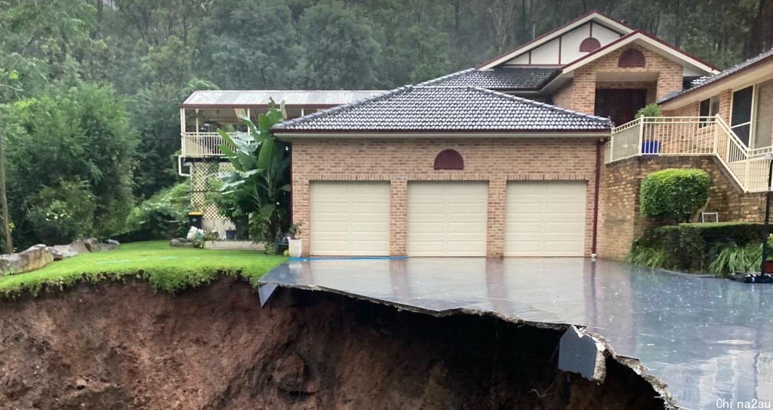
 悉尼民宅遭遇山体坍塌,几乎一半“悬空”!居民惊魂未定:“噩梦,像看电影”(组图)
0条评论
DailyTelegraph
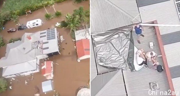
 幸运!新州五口之家爬上屋顶躲洪水,被路过的特别任务直升机救起(组图)
0条评论
Yahoo
 新州超级暴雨洪灾,数万人无家可归!您家是否受灾?两笔津贴详细申请攻略送上
0条评论
艾欧
 澳洲中文论坛热点
- 悉尼部份城铁将封闭一年,华人区受影响!只能乘巴士(组图)
- 据《逐日电讯报》报导,从明年年中开始,因为从Bankstown和Sydenham的城铁将因Metro South West革新名目而
- 联邦政客们具有多少房产?
- 据本月早些时分报导,绿党副首领、参议员Mehreen Faruqi已获准在Port Macquarie联系其房产并建造三栋投资联